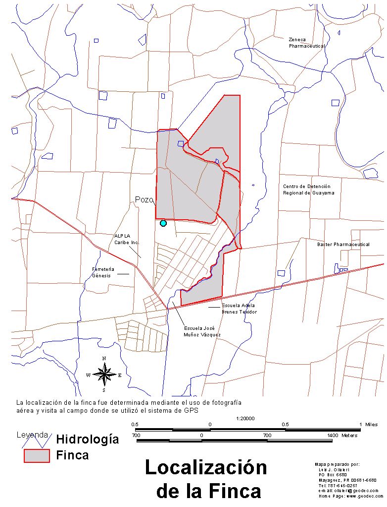
Example of the use of GPS
Location of a Farm and other features within the farm.
The technology of Global Positioning Systems (GPS) offers a good means to locate very fast and accurately any feature or structure over the surface of the Earth. With a preliminary location of an area using aerial photography, we can find the approximate boundaries of a farm. Later, visiting the field, using the technology of GPS we can locate these boundaries more accurately. With GPS we can even locate features such as structures, roads, and wells within the farm .
Because of the nature of the file generated by GPS, this information can be combined with other GIS data.
Press on the map to enlarge.
|