Example of the use of remote sensing:
Land use
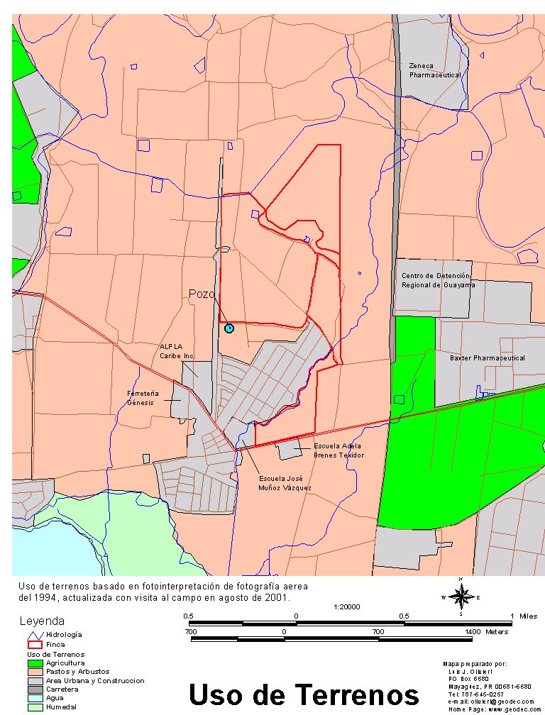
The following map shows the land use of an area. The classification was done using aerial photo interpretation and field visits to update and validate the classification.
Press on the map to enlarge.
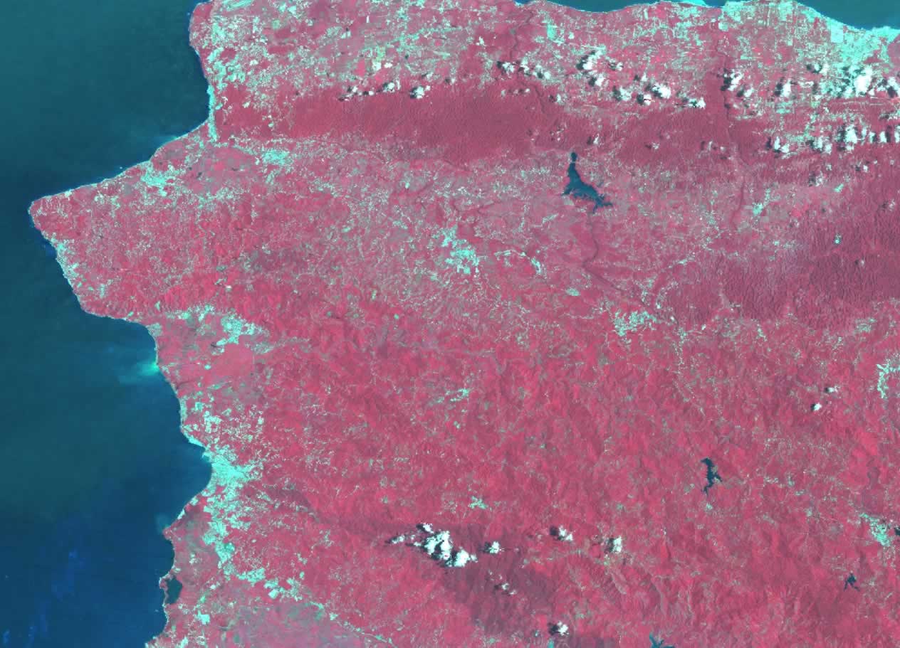
The same way, satellite images could be used to classify larger areas in a faster way. The following image was taken with the Thematic Mapper Sensor in the Landsat 7 satellite. This satellite flies over 400 miles above Earths. The image represent a false color infrared which represent the infrared (IR) part of the spectrum with color red. Vegetation (the chlorophyll) has the spectral characteristic of reflecting a lot of energy in the IR part of the spectrum. That means that areas in red in the image represent vegetation. Then areas in light blue represent areas without vegetation such as bare soils and urban areas. Clear water in the other hand absorbed energy in the IR and visible part of the spectrum so, water will look darker in color. If you enlarge the image, you will notice sediment caried out by water into the sea, coming out of the Rio Grande de Añasco.
Press on the image to enlarge.
|